Today, we share with you an R&D project that our team has been working on for several months: the estimation of river flow rates, made possible by combining the surface velocity field, water height, and the geometry of the watercourse. This major advancement forms the foundation of an innovative river forecasting system and a significant step towards reducing vulnerability to water-related risks.
The importance of knowing the flow rate of a watercourse
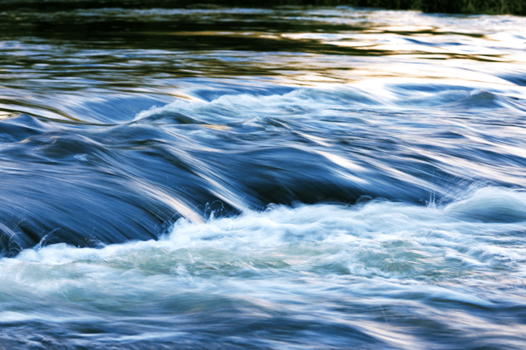
To assess a watercourse, there are two important criteria to evaluate: its quality and its quantity. After telling you about our work on measuring water quality, today we’d like to tell you about our progress on quantitative measurements. For this purpose, there is a key metric to measure: its flow rate, which is the volume of water passing through the cross-section of a watercourse.
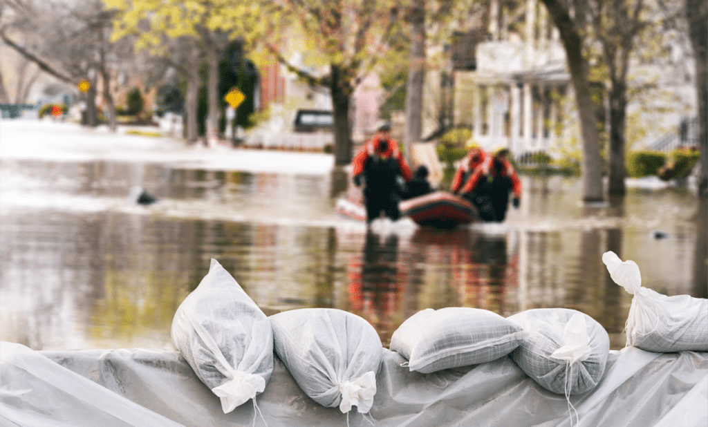
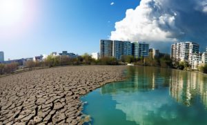
The knowledge of a watercourse’s flow rate is important for various purposes, including flood characterization (or low-flow, drought), management of hydraulic structures, agriculture (through irrigation), survival of aquatic species, and many other subjects. This knowledge is all the more crucial in addressing broader challenges such as climate change, water sharing, and biodiversity.
Current flow rate measurement techniques
There is currently no universal method or instrument for flow measurement. The choice between various methods depends on a multitude of factors such as resource availability, required accuracy, and specific morphological characteristics of the watercourse.
The various existing methods are :
- Velocity field gauging methods (the most common ones): These involve exploring the velocity field, meaning flow velocities are measured at various points across the flow section (both horizontally and vertically). For this, there are numerous methods, the main ones being the hydrometric wading rod method (measuring the flow velocity of the watercourse using a propeller rotating proportionally to the local flow velocity), the ADCP method (based on the Doppler effect, involving the emission of acoustic pulses into the water and analyzing changes in their frequency upon reception), gauging stations (permanent installations equipped with flow measurement instruments, which can include pressure sensors, acoustic sensors, electromagnetic sensors, etc.), or satellite remote sensing systems (using satellite data to monitor changes in water surface, allowing flow rate estimates, although this is more commonly used for large rivers or extensive areas).
- Tracer dilution gauging: this involves the controlled introduction of a chemical product, such as salt or a colored tracer, into the watercourse. The assessment of the degree of tracer dilution then allows the calculation of the watercourse’s flow rate by measuring the tracer concentration at a sufficient distance from the injection point, where the tracer mixing is considered complete. This approach is relevant for relatively modest flow rates, reaching a few cubic meters per second, and proves particularly suitable for turbulent flows that facilitate efficient dispersion of the tracer.
- The capacity gauging method consists in assessing the flow of a watercourse by measuring the time required to fill a container of predetermined volume. Although this approach offers a direct measurement of flow, it should be noted that its range of application is relatively restricted, limited by constraints inherent in the method. Furthermore, its implementation, especially in a river environment, can be complex due to various operational factors.
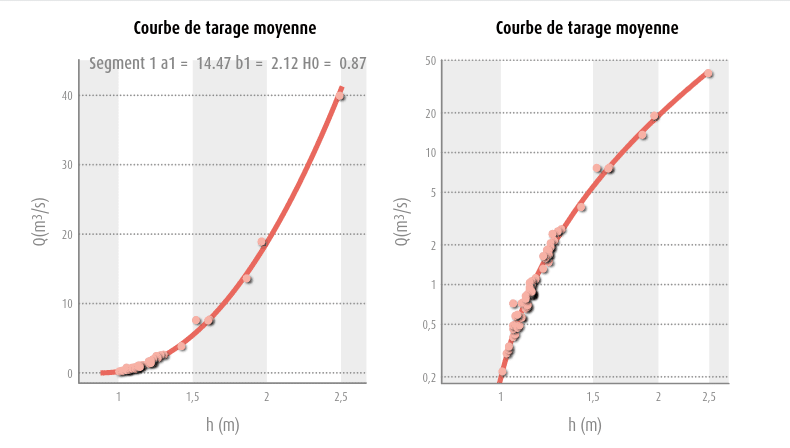
The combination of the measured velocity with the cross-sectional area allows the reconstruction of instantaneous flow rate at a specific point. By repeating these measurements under various hydrological conditions and correlating them with the water height at the time of measurement, rating curves are established. While they provide an estimate of the flow rate based on a single water height measurement, these curves require regular updates. Indeed, the shape of riverbeds can evolve over time due to various factors such as vegetation, human intervention, floods, etc.
Our approach involves combining data already measured by the vorteX-io micro-stations.
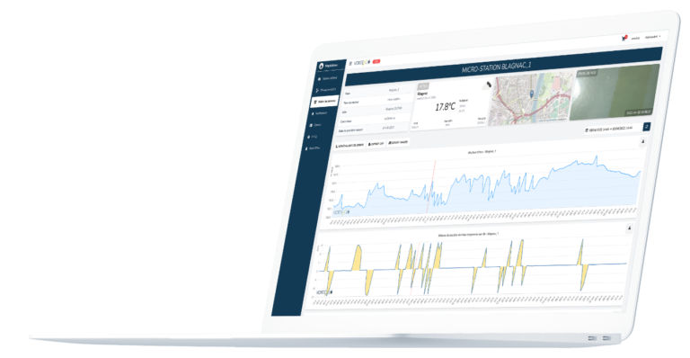
Our micro-stations already provide two essential real-time data points: water height and surface flow velocity.
The precision of water height measurement is ensured by a LiDAR, allowing centimeter-level measurement without contact with the watercourse and without measurement drift over time (thanks to the use of LiDAR technology). As vorteX-io micro-stations are securely mounted on robust structures such as bridges, maintenance needs are significantly reduced, and the quality of measurements is improved.
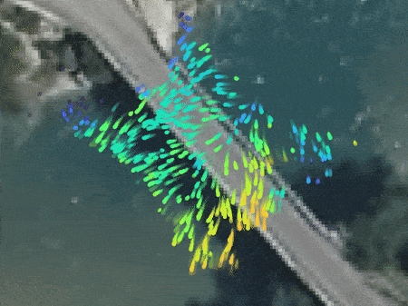
Regarding surface flow velocity, it is assessed by applying an algorithm to the video footage captured by the micro-stations. This approach, based on state-of-the-art technology, provides an accurate and reliable estimate of surface current velocity.
… and a fresh innovation
The remaining element to determine is thus the geometry of the flow section, crucial information for quantifying the volume of water in transit and, consequently, for generating an estimate of the flow rate.
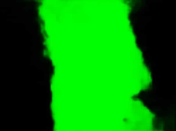
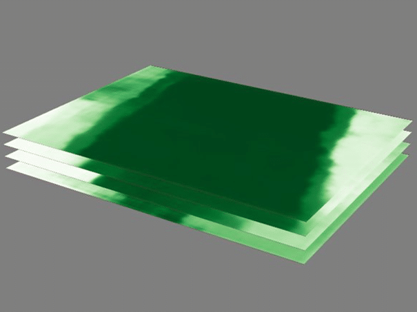
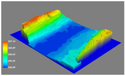
By default, vorteX-io micro-stations do not provide bathymetry. However, the use of an iterative process makes up for this shortcoming. We use a Machine Learning algorithm, which we have previously and extensively optimized, to identify water-occupied areas in the captured images. This automatic detection allows for creating a ‘water mask’ to retain only the image surface actually occupied by water. Given that the water height is known for each image, this allows for calculating the planar geometry of the watercourse at that specific height. By combining water height measurements with the complete history of captures at different levels, it becomes possible to reconstruct the precise geometry occupied by the water surface in overlapping horizontal “layers“.
This approach not only allows for the updating of bathymetry closest to the terrain but also ensures consistently updated flow rate measurements. This revolutionary method ensures the accuracy of the flow rate estimates obtained by the vorteX-io network’s micro-stations.
Transforming these measurements into flow rate estimation
The combination of the surface velocity field, water height, and watercourse geometry then allows for a precise estimation of the flow rate under the micro-station.
This estimation plays a crucial role in establishing and updating the rating curves specific to each station. These curves thus provide an estimate of the flow rate correlated with the measured water height, even when the image capture conditions do not allow for a direct assessment of flow velocities. Thus, we can provide the flow rate of a watercourse at the same frequency as other data we measure: that is, one to four times per hour under normal conditions and four to six times per hour in the case of threshold exceedance (these frequencies are defined by the user).
The real-time estimation of river flow rate enabled by these measurements represents a major advancement for continental hydrology, and the resulting applications are numerous and significant. This innovation will soon enhance the prevention of natural water-related risks (floods and droughts) and improve water resource management, both at the local and large-scale levels.
The continual improvement of this knowledge forms the very foundation of the development of a pioneering river forecasting system deployed by vorteX-io in Europe through its WHYLD project.
The vorteX-io Newsletter
Get the latest news from vorteX-io:
projects & innovations, updates of the Maelstrom® platform, in-depth articles about hydrology...