Surface temperature
Benefit from a clear, usable temperature display in real time to support your decisions and actions.
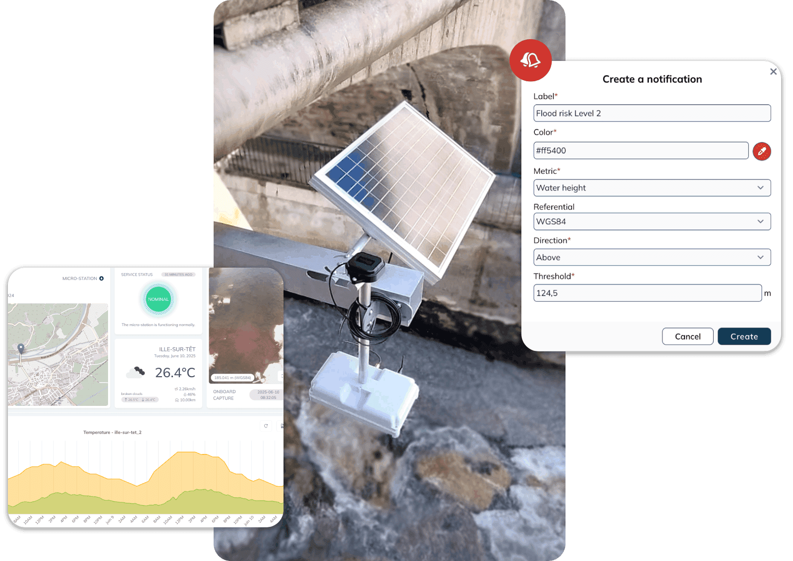
Our customers
Get the surface temperature now



The solution for preserving water quality
Surface temperature monitoring facilitates your activities and prevents deterioration in water quality. Preservation of ecosystems, thermal control of discharges, prevention of risks linked to drought and rising temperatures.
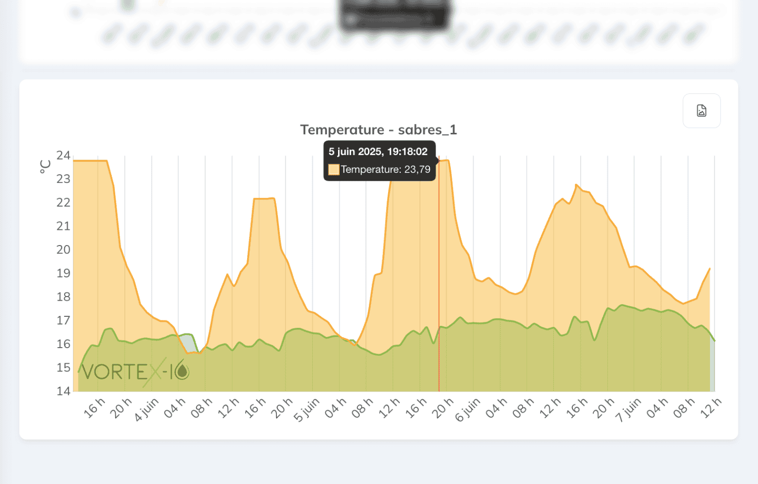
Real-time and historical measurements
Up-to-date and historical data for better understanding and action
- Updates every 15 minutes
- Access to measurement history
- Highlighting trends and anomalies
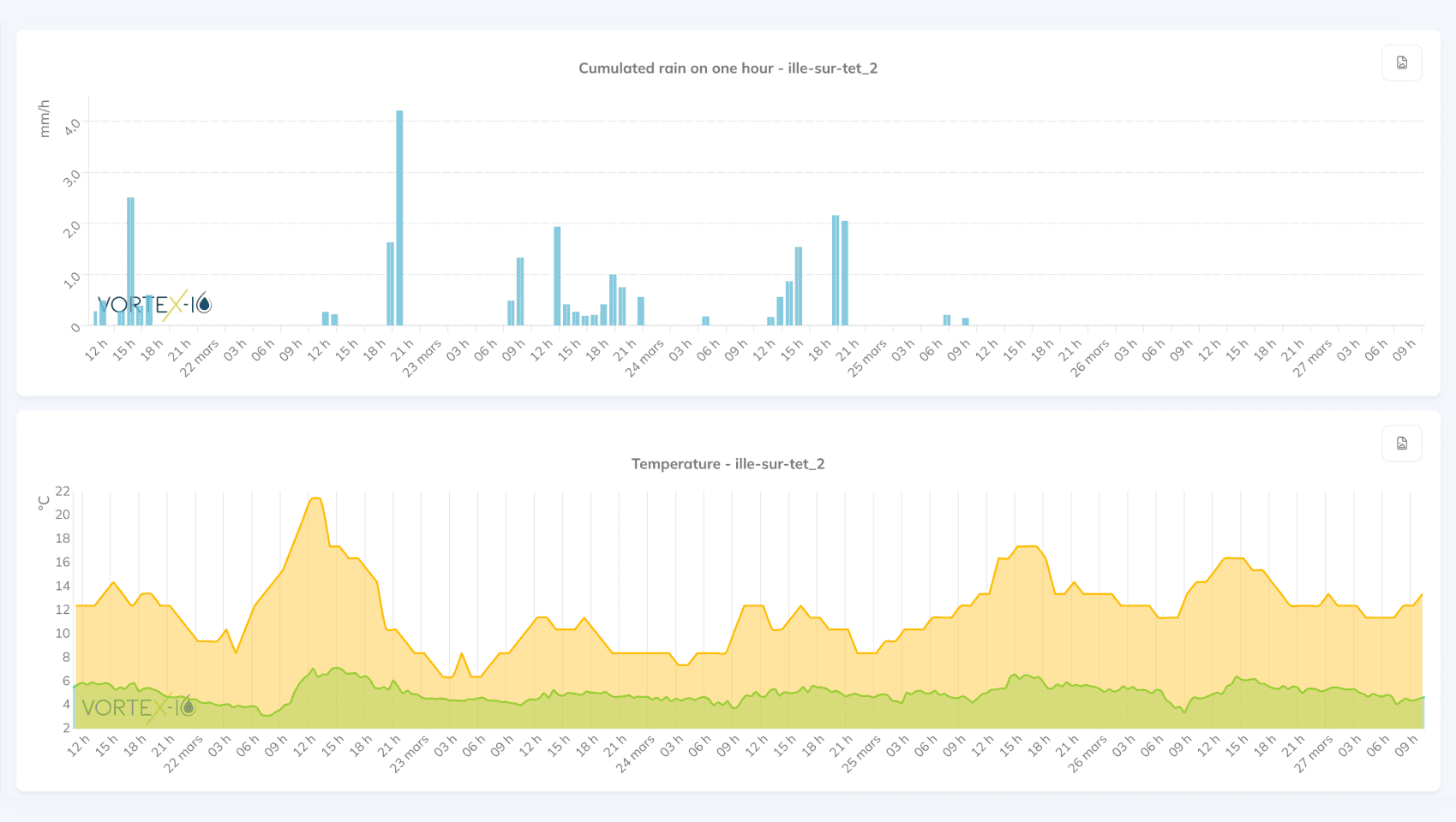
Multi-parameter analysis
Easily monitor several key parameters simultaneously
- Water surface temperature
- Water level
- Surface speeds and flow rates
- Air temperature
- Cumulative precipitation
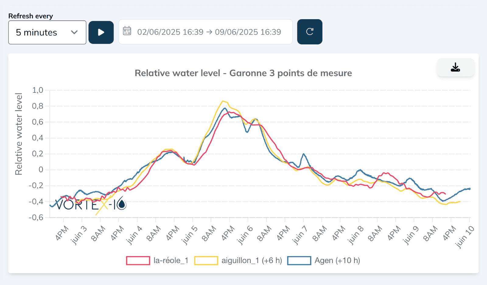
Before/after measurements
Identify the impact of natural and human phenomena:
- Upstream/downstream of a discharge zone (industrial, agricultural, urban)
- Upstream/downstream of a wetland or forest
- Before/after an event: storms, floods, droughts, heat waves

Benefits
Temperature, a pillar of environmental protection
Continuous monitoring of surface temperature plays a crucial role in many fields.
Risk monitoring and prevention
Analysis of the effects of climate change, preservation of aquatic ecosystems, management of protected areas, detection of critical phenomena
Water resources management
Adjustment of agricultural irrigation practices, observation of variations in hydrological cycles, monitoring of the thermal effect of water releases.
Thermal discharge monitoring
Limiting the impact of thermal effluents in waterways, controlling wastewater discharges, preserving aquatic environments
Research and innovation
Heat flow modelling, validation of hydrological models
Legislation and regulations
Meeting regulatory requirements, helping to arbitrate conflicts of use

Trust at the heart of service
Real-time accuracy & reliability
Thanks to reliable, continuous measurements, vorteX-io opens up previously unattainable opportunities.
±1°C
precision in surface temperature measurement
97,5%
data accessible in 15 minutes
Would you like to test our service?
Create your account in 2 minutes and try vorteX-io for free(no credit card required).
A better overview
Use our network of stations to monitor surface temperature data at several points on the same watercourse or spread across a watershed.
How does it work?
Our 4-step offer
To manage, you need to know.
To know, you have to measure.
In-depth knowledge of your watercourses relies on precise, continuous monitoring.
1. Collecting measurements
Our stations incorporate several sensors: LiDAR, camera, thermal sensor, GNSS system and accelerometer, for continuous multi-parameter measurement powered by solar panels.
2. Transmission and processing
Measurements are transmitted by 3G/4G to our secure servers, and are available on vorteX-io in just a few minutes.
3. Data visualization
Centralized, processed and standardized, this data feeds a constant flow into our platform. range of innovative hydrological services.
4. Decision support services
You can consult, compare, analyze and even receive notifications to help you decide what action to take.
FAQs
Find out the answers to the most frequently asked questions about our hydrological solutions.
Contact usNo, the stations are not submerged, which increases their durability and measurement stability compared with submerged sensors.
Our stations use the GSM network to automatically transmit measurements taken in the field. In the event of a network failure, data is stored onboard and sent once the connection is re-established.
They are totally self-sufficient in energy thanks to their solar panel and on-board battery, enabling them to be installed in areas with no electrical grid. On the other hand, 3G/4G coverage is required to ensure proper transmission of measurements/data.
Anticipate hydrological hazards
Whether you’re a local authority, a company, a transport network or an insurance organization, find out how vorteX-io helps you monitor, anticipate and act.